
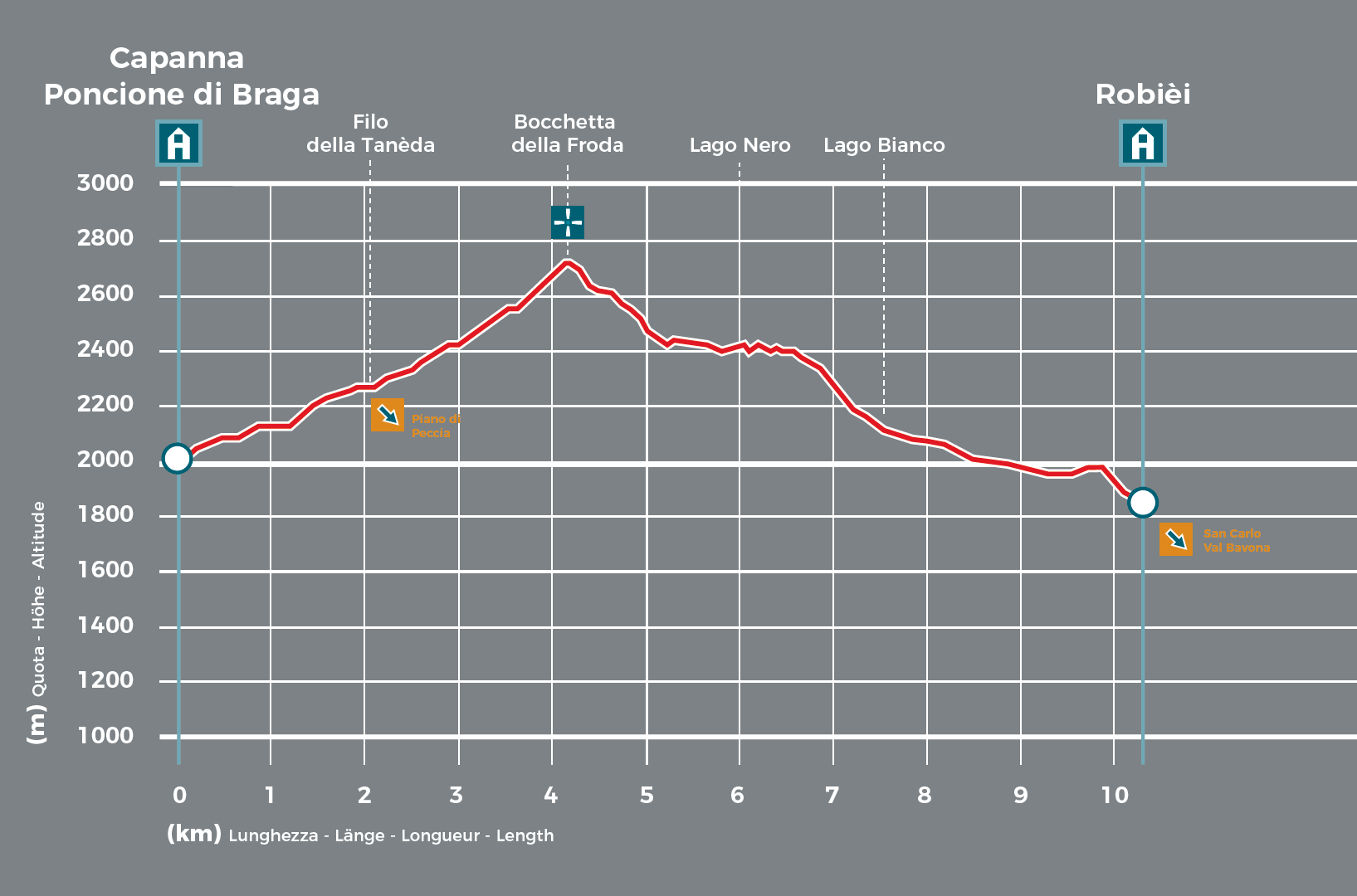
The first hour is spent leisurely climbing up the vast green slopes of Alpe Masnee, lit by the morning sun, as a warm-up for the trek ahead. You then continue along a rocky stretch, with the little gem of Lake Froda on your right, guiding you to Poncione di Braga.

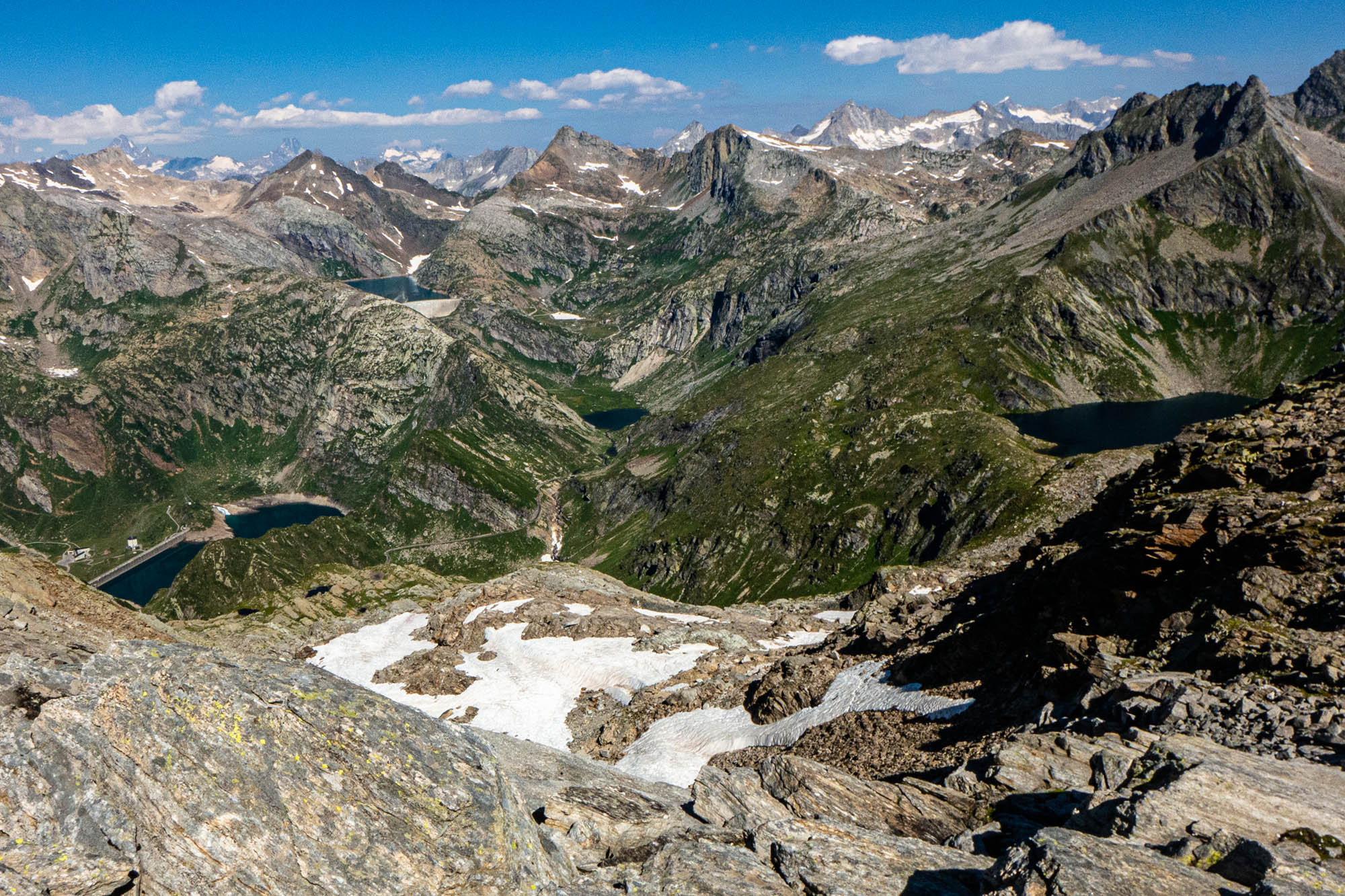
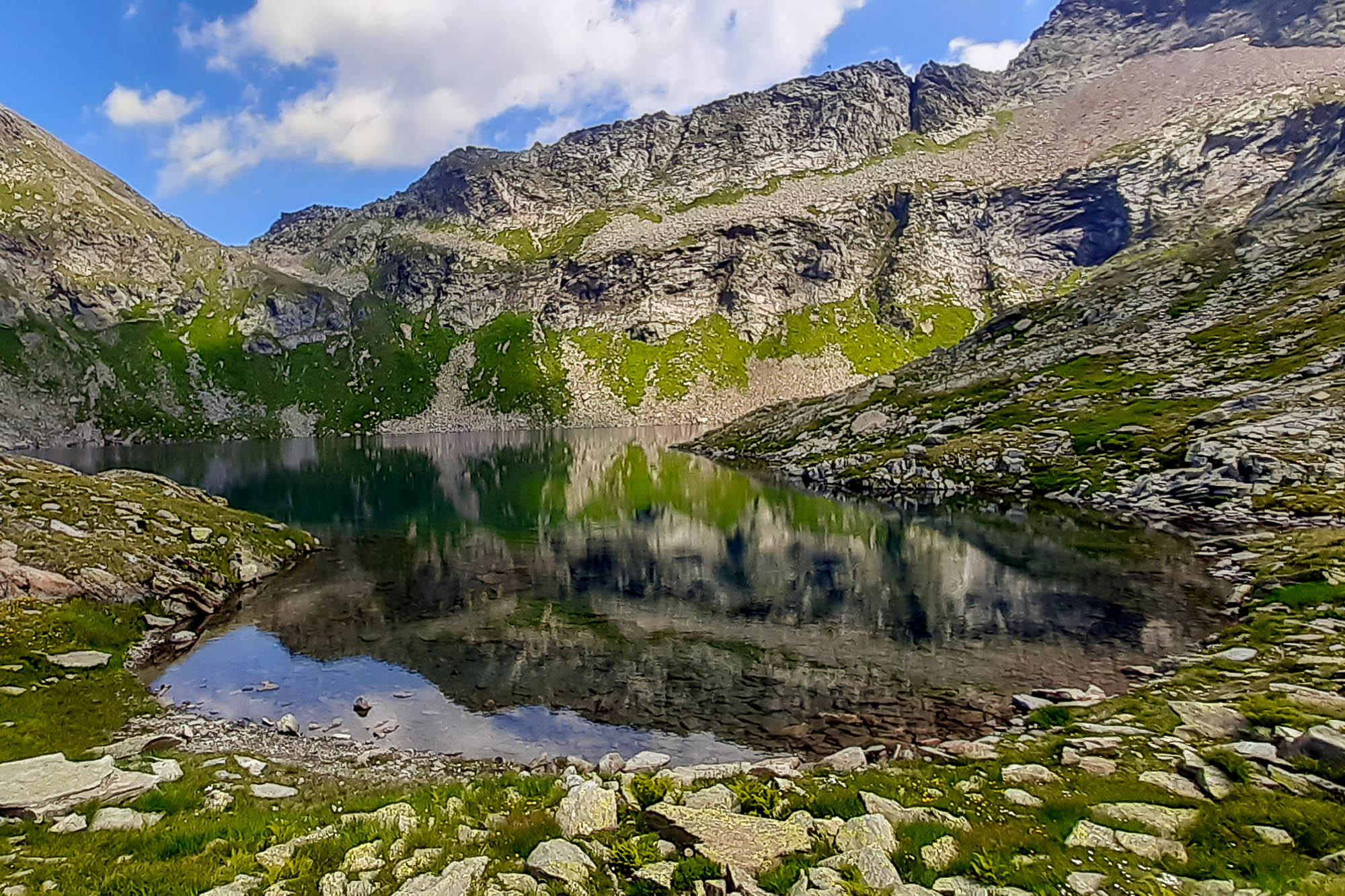

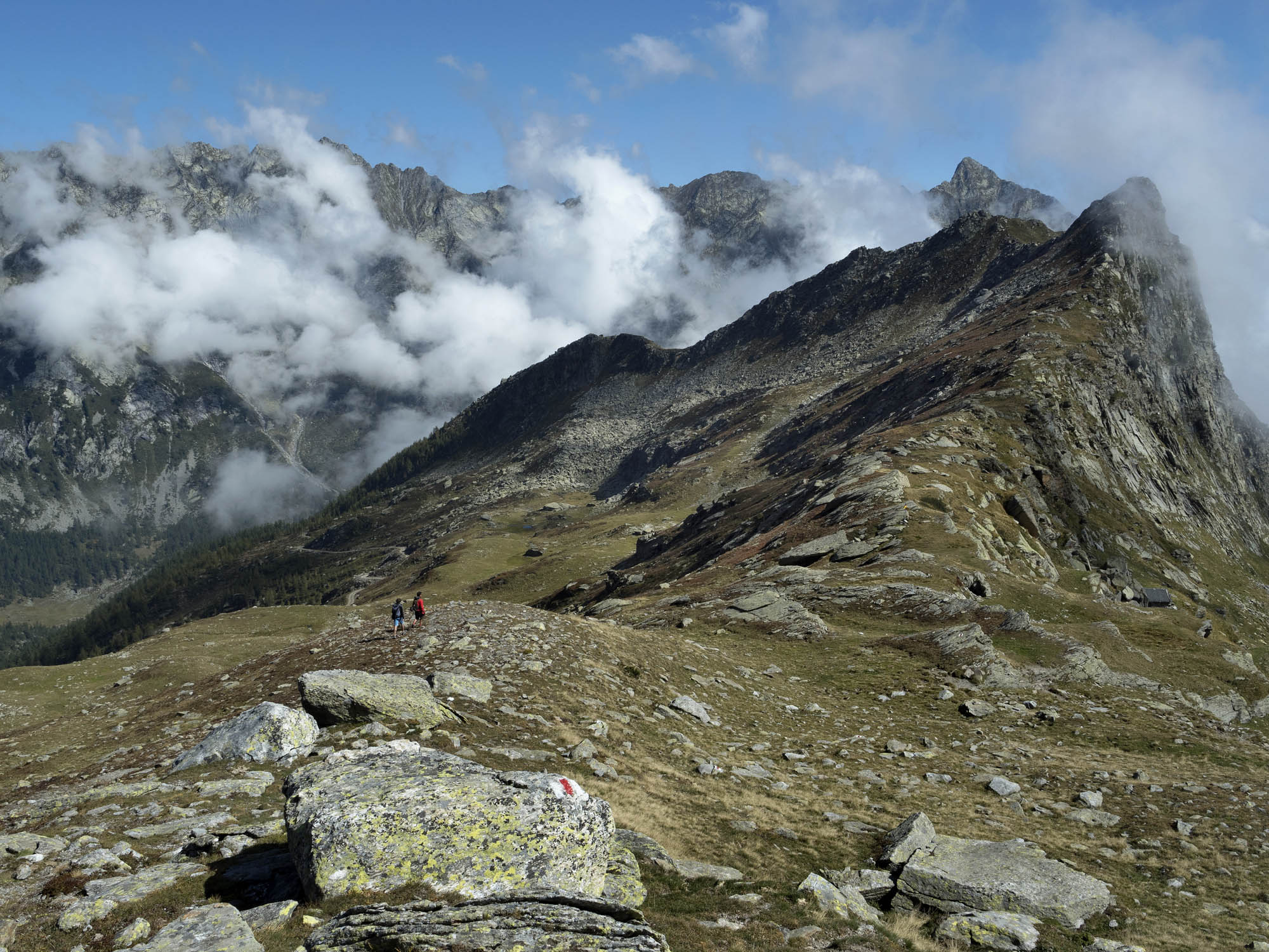

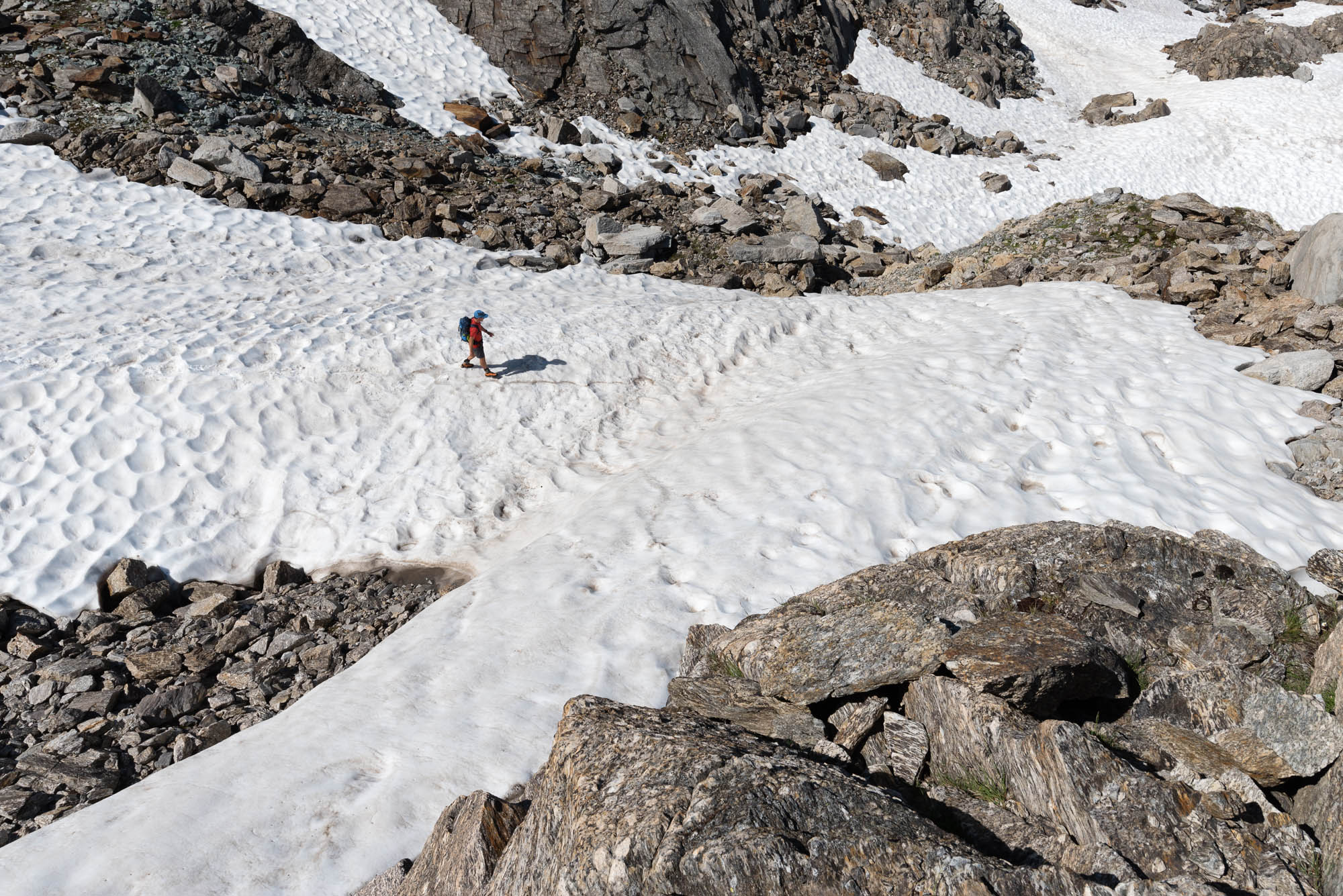
Your destination, however, is not the summit, but Bocchetta della Froda, a wide saddle on your right. The pass offers a sweeping view of countless peaks, first of all the Basòdino, the second highest massif in the Ticino Alps, crowned by its glacier, the largest in the canton. From there, the trail continues downhill towards the Robièi valley. If you are lucky, you may even see a herd of ibexes grazing up close. The path eases out and goes on to skirt Lago Nero and then Lago Bianco. You eventually reach Robièi, a popular destination for local hikers as well as hikers from further afield, connected to the Bavona Valley by a cable car.
- Capanna Poncione di Braga (2003m)
Website
Book online - Capanna Basodino (1856m)
Website
Book online - Albergo Robiei (2000m)
Website
Technical Data
-
Stage length
10,3 km
-
Height difference ascent
830 m
-
Height difference descent
980 m
-
Maximum height
2708 m
-
Duration
04:45 h
-
Difficulty
T4
Download
Support the mountains
Support the association Via Alta Vallemaggia