
Apart from the first section of the route, between Cardada and Masnee, the Via Alta trekking route runs along the slopes, only occasionally climbing to peaks and ridges. Hiking is about much more than just following the ridges.
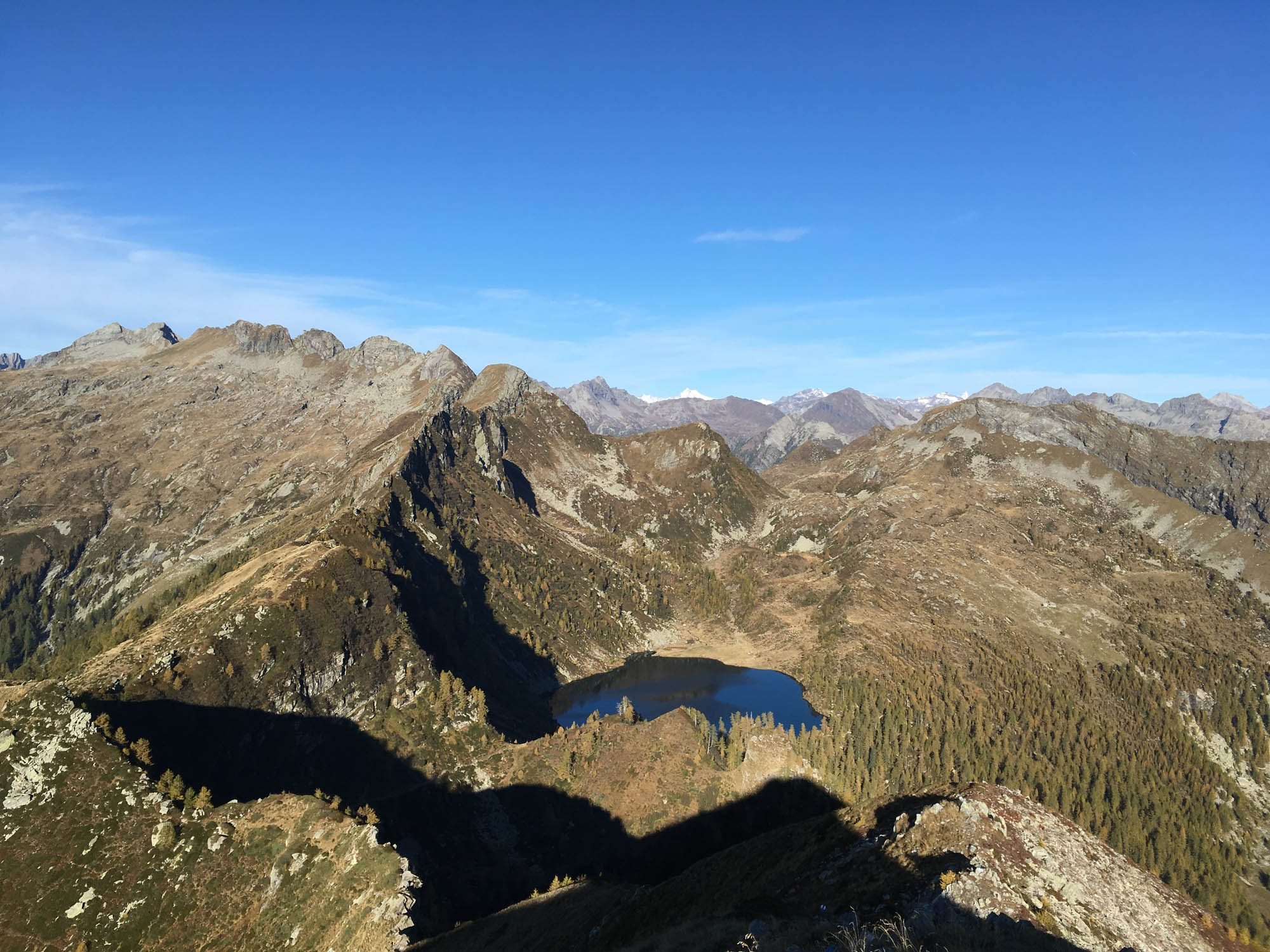
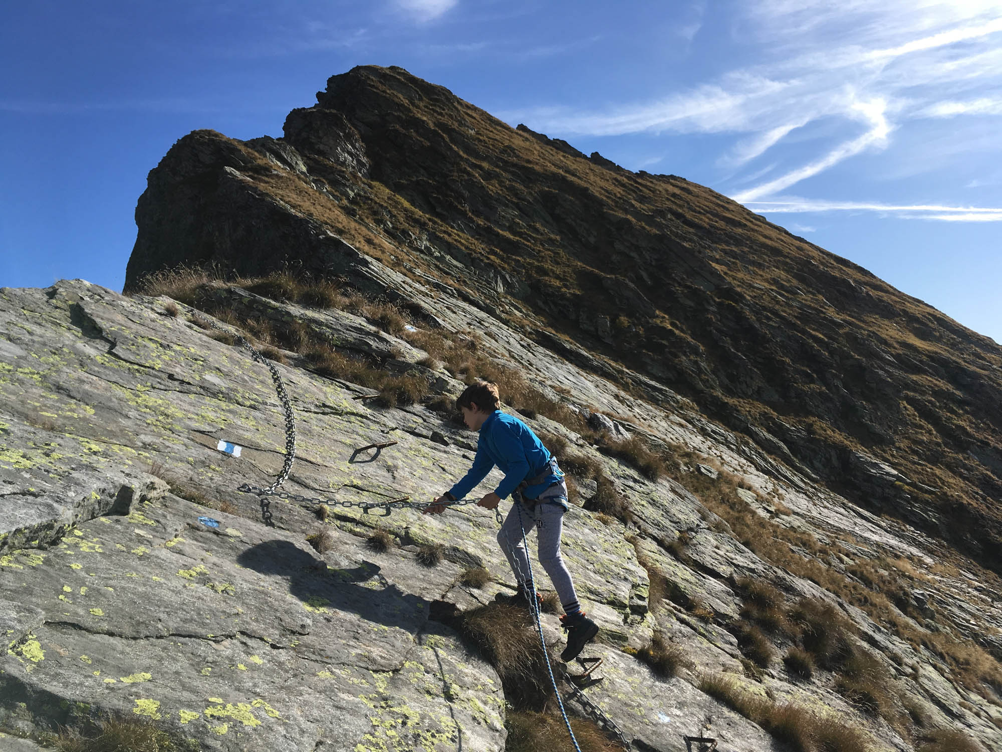
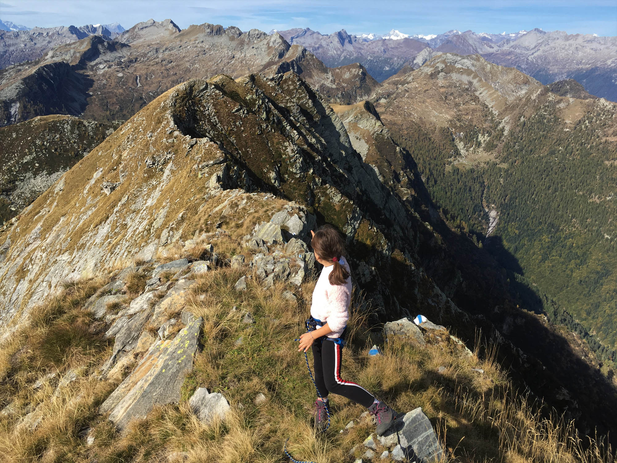

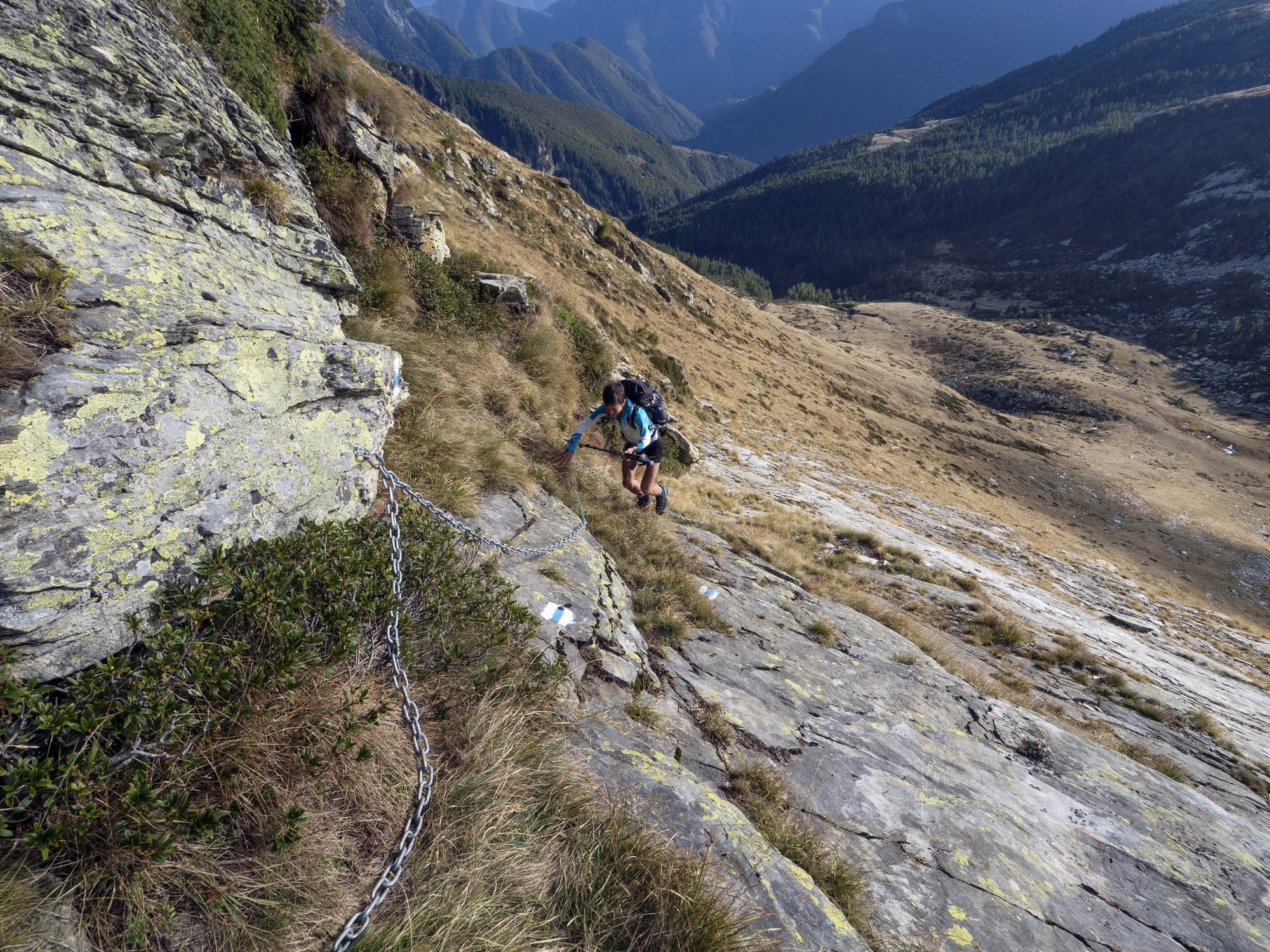
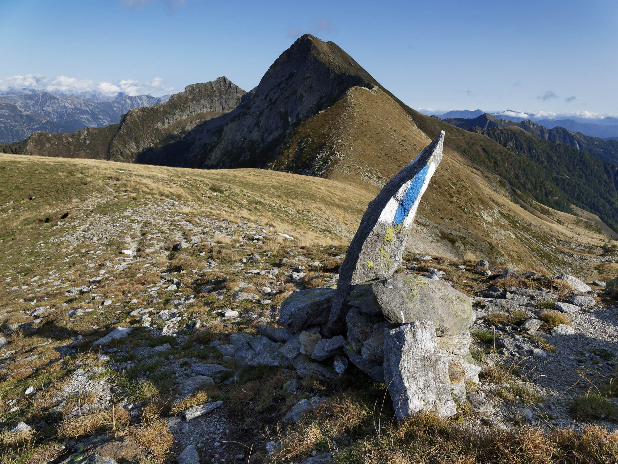
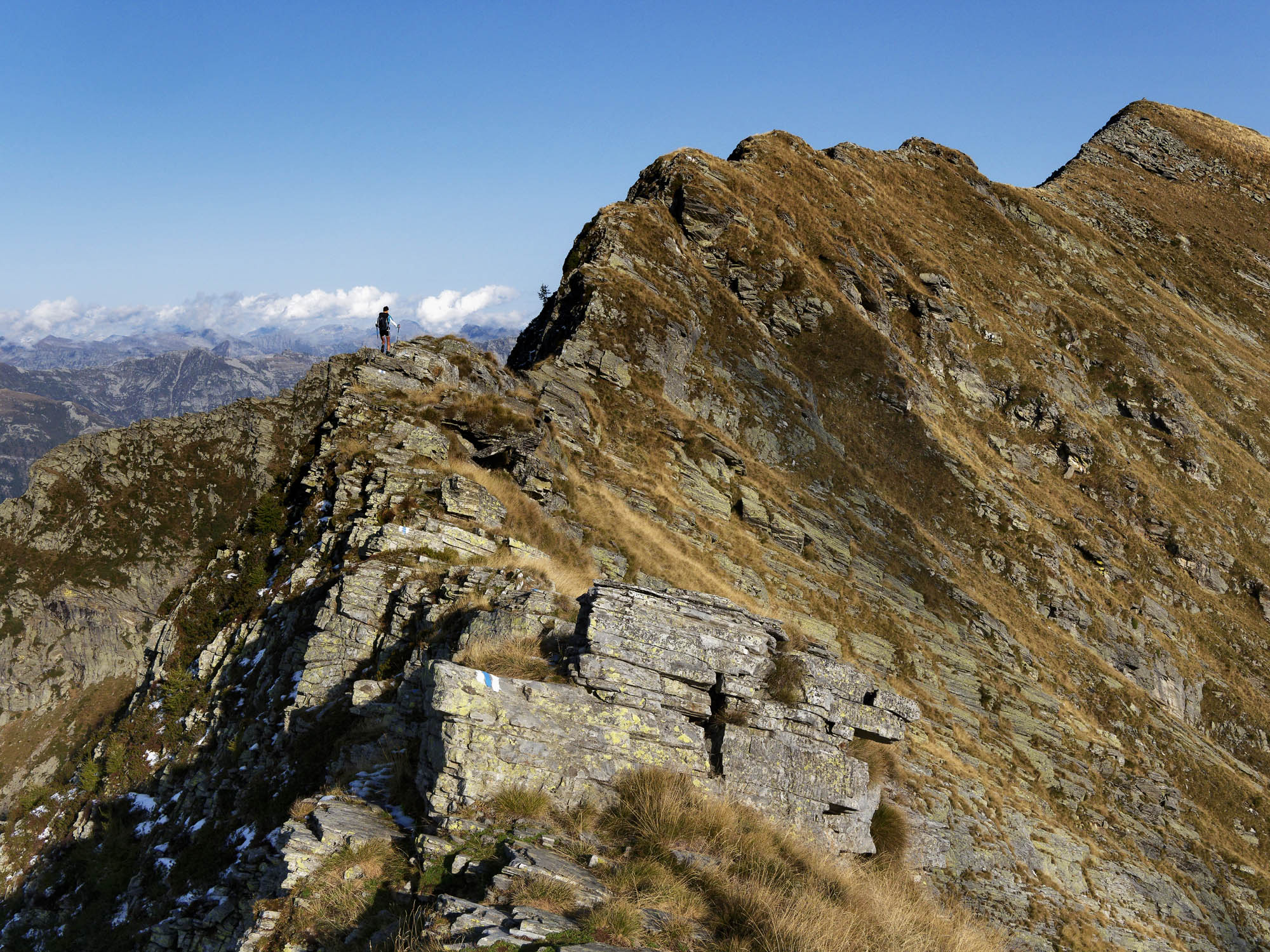
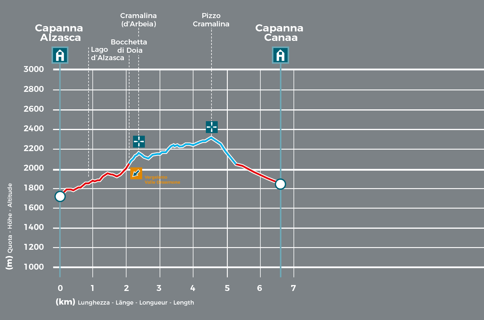
However, the topography between Alzasca and Canaa levels out just enough to offer a panoramic view from atop the mountain ridge: the trail from Bocchetta di Doia alternates between wide, comfortable sections and others that are more craggy and exposed. The route covers terrain of varying elevations and runs along the ridge between the Vallemaggia and Onsernone valleys, except for a crag that requires a detour along a ledge using the chains provided. The very attractive ridge ends at Pizzo Cramalina, a striking peak and the highest in the Lodano Valley. At the foot of the mountain you can already see the farmhouses of Canaa, restored in accordance with the building traditions of Alpine farmers: Created from abandoned buildings, the mountain lodge is a gem: an oasis of tranquillity.
- Capanna Alzasca (1734m)
Website
Book online - Capanna Alpe Canaa (1843m)
Website
Book online
Technical Data
-
Stage length
6,6 km
-
Height difference ascent
710 m
-
Height difference descent
610 m
-
Maximum height
2322 m
-
Duration
03:45 h
-
Difficulty
T4+
Download
Support the mountains
Support the association Via Alta Vallemaggia